Cattleman’s Square: A Crossroads Through Time
Cattleman Square, located on San Antonio’s historic Westside, is a district shaped by movement, commerce, and community. Over time, it has served as a place where transportation routes, economic activity, and cultural life intersected. From early Indigenous settlement patterns to the cattle trade, the arrival of the railroad, and the growth of surrounding Westside neighborhoods, the district reflects many of the forces that shaped San Antonio’s development.
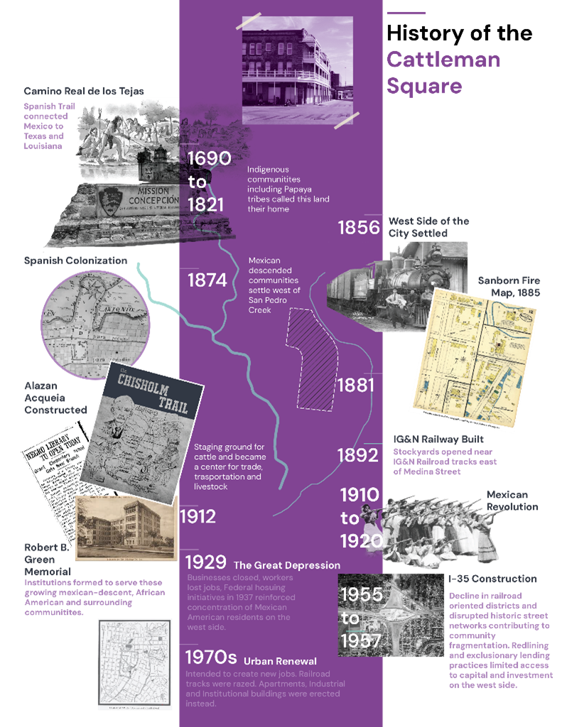
Indigenous Roots and Early Settlement
Long before railroads or cattle drives, Indigenous communities lived across this region. Groups like the Payaya (Coahuiltecan) people moved through and settled along the waterways that ran across the Westside. Rivers and creeks such as Alazán Creek and the San Antonio River were essential corridors for life — providing water, food, and natural routes for travel. Communities formed along these waterways, creating settlement patterns closely connected to the land and its resources.
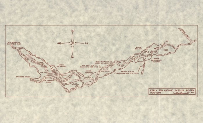
Later, when Spanish settlers arrived in the 1700s, missions and irrigation systems were established in the region. The area west of the river remained more rural, connected to ranching lands and open landscapes outside the early settlement of San Antonio.
By the 1800s, the area began to take on a new role.
San Antonio was becoming a center for ranching, and cattle drives moved north along the Chisholm Trail. The area that would later become known as Cattleman Square served as a gathering place for ranchers and traders moving livestock through the city. Its association with this activity eventually gave the district its name.
The Railroad Era: A Hub of Commerce and Transportation
The most significant transformation came with the arrival of the railroad.
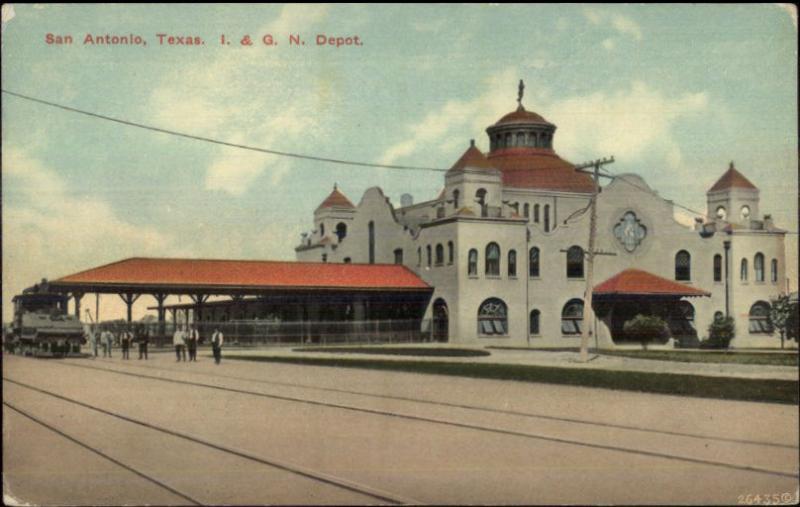
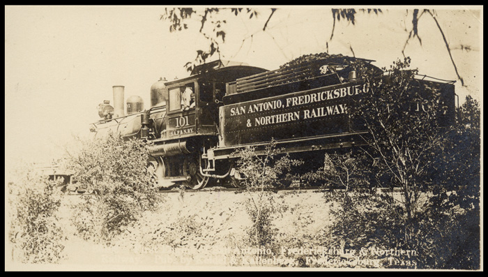
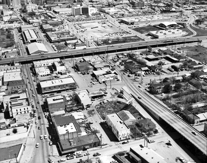
In the late nineteenth century, the International & Great Northern Railroad established a line through the area, turning the district into a major transportation and commercial hub. Trains carried livestock, goods, and passengers, and the surrounding blocks quickly filled with warehouses, markets, hotels, and businesses serving the rail trade.
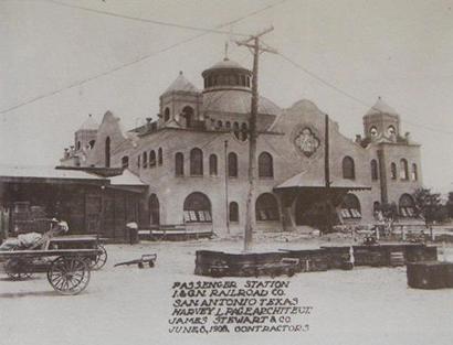
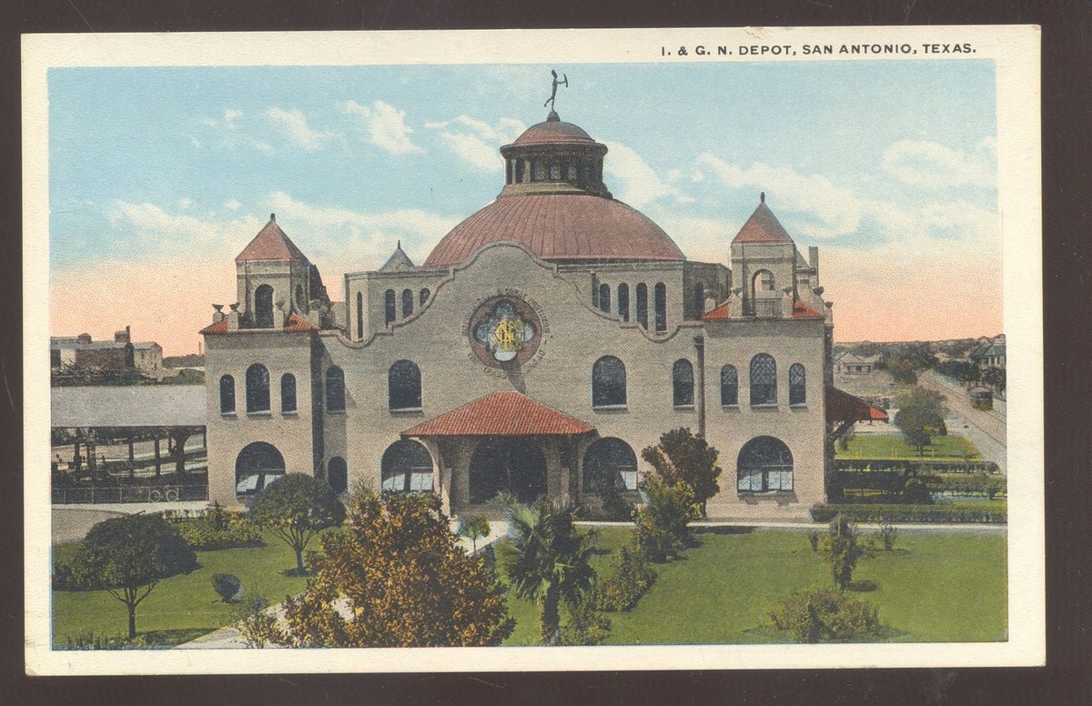
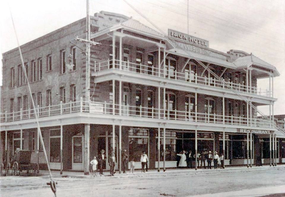
One of the district’s most recognizable landmarks is the International & Great Northern Railroad Depot, constructed in 1907. The station served as a gateway for travelers arriving in San Antonio. Across the street stood the Heimann Building, originally built as a hotel for railroad passengers and workers. Together these buildings anchored a busy transportation corridor.
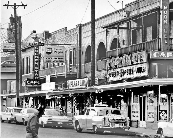
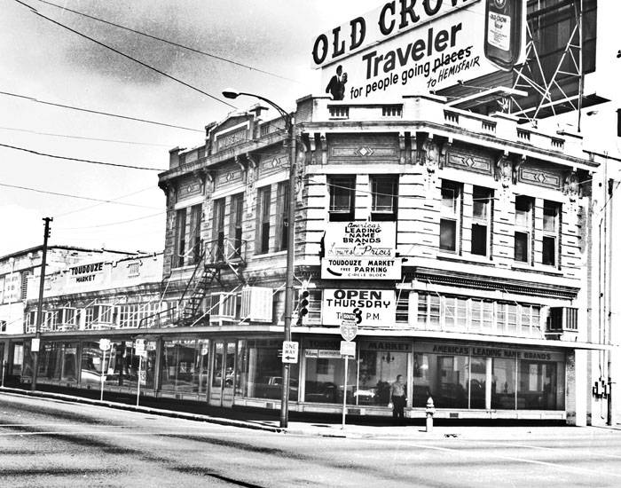
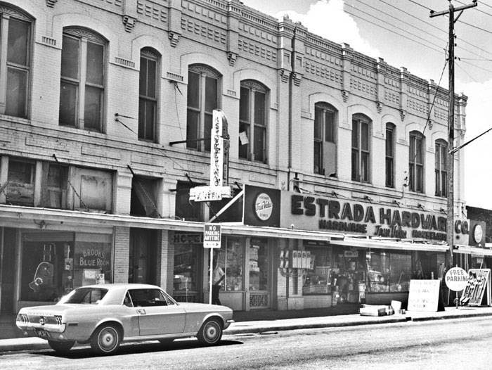
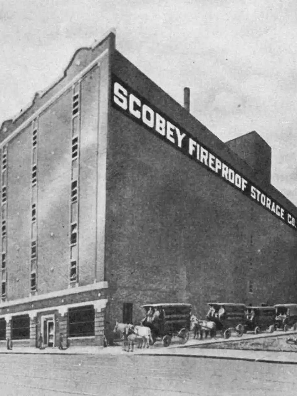
Nearby, Commerce Street developed into an active commercial corridor lined with shops, markets, and services. Buildings such as the Toudouze Market were part of the district’s everyday economic life, while warehouses like the Scobey Building stored goods moving through the rail system.
Westside Communities and Urban Change
At the same time, neighborhoods across the Westside were growing. Mexican American and Black families built strong communities nearby, establishing schools, churches, and local businesses that shaped the cultural identity of the area. The district was not only a center of commerce but also closely connected to the social life of the surrounding neighborhoods.
Important civic institutions were also established in the district. The Robert B. Green Memorial Hospital, constructed in the early twentieth century, became one of the city’s major public hospitals and served generations of residents.
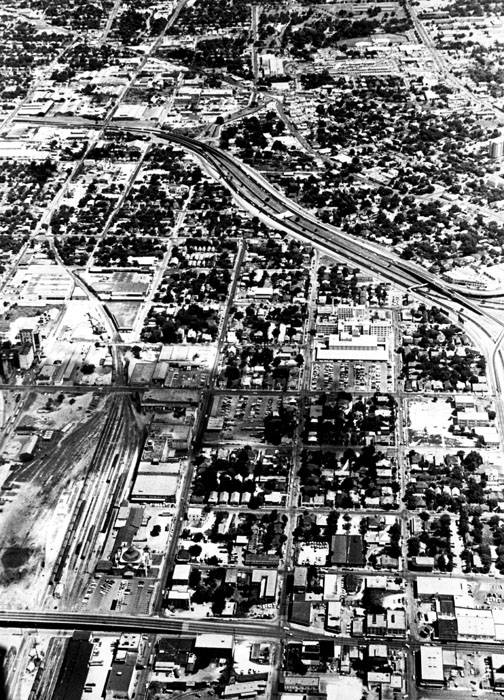
Like many districts shaped by rail transportation, Cattleman Square experienced significant changes in the mid-twentieth century. As automobiles and highways replaced trains as the primary means of travel, passenger rail declined. The construction of Interstate 35 introduced a major physical barrier between the district and downtown, disrupting historic street connections and contributing to economic decline.
Today, Cattleman Square contains visible layers of history — from Indigenous settlement patterns shaped by waterways, to the cattle trade that gave the district its name, to the railroad infrastructure that defined its growth, and the communities that built life and culture around it.
These layers continue to shape how the district is understood today, as the community considers how its next chapter will unfold.
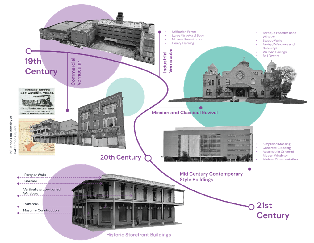
Architecture and Physical Character
Cattleman’s Square’s architecture reflects its origins as a working district. Buildings are practical, durable, and designed to adapt over time. Many date from the late 19th through mid-20th centuries and include storefronts, warehouses, civic buildings, and institutional structures.
The historic core includes buildings close to the street and arranged in walkable blocks. Over time, larger parcels and auto-oriented patterns introduced surface parking and setbacks at the edges. Together, these patterns show a district that evolved incrementally, building by building, rather than through a single plan.
Built to Last, Built to Adapt
One of the district’s strongest assets is its building stock. Many historic masonry structures remain structurally sound and have the flexibility needed for reuse. Warehouses offer wide-open interiors suitable for new uses, while traditional storefront buildings support ground-floor activity and reinvestment.
This creates opportunity for a future shaped by adaptive reuse. Reuse reinforces identity while making room for new housing, local businesses, public life, and community-serving spaces
Why This Matters for Project DC
The history, culture, and architecture of Cattleman’s Square are not background. They are the framework for the district’s future. These existing conditions guide how Project DC approaches reinvestment:
- Strengthen connections and reduce barriers
- Reuse and reinvest in historic buildings where feasible
- Support community stability and affordability
- Celebrate the district’s identity through design, programming, and storytelling


